
Walk an Idaho Falls Street
An Idaho Falls street directory search works best as a chain. Begin with the exact current address and keep the postal form apart from the physical, or situs, address. County maps identify the parcel. Recorded instruments then connect that parcel to named parties. Voter information and printed directories may add dated signs of residence, but neither should be treated as a complete household roll.
- Normalize the street number, directional, name, type, unit, city, ZIP, subdivision, and likely year.
- Search the Bonneville County Parcel Viewer by situs and save the parcel ID and map date.
- Inspect the same road in City Street Mapping and note city limits, subdivision, and nearby parcels.
- Run the parcel, situs, grantor, and grantee through the Recorder index, saving each instrument number.
- For an older address, compare directory years, Sanborn maps, historic aerials, and newspaper notices.
The resulting chain can establish ownership and show who appeared at the address in a dated source. It cannot prove that every named person lived there. An owner may receive mail elsewhere, a permit signer may be an agent, and a deed grantee may be a trust.
Normalize Idaho Falls Street Numbers
Idaho Falls uses two baseline systems. Chapter 6 of the city street-numbering rules separates the Original Townsite from the rest of the city. Original Townsite numbering uses South Eastern Avenue and Walnut Street extended west as the initial point. Outside it, First Street extended and North Boulevard establish another initial point and baseline pattern.
The usual rule adds 50 numbers per block on each side. Even numbers sit on the right and odd numbers on the left when facing away from the baseline. A dual-direction street changes numbering at the center of a curve, and separate occupancies receive separate numbers. These rules explain why a historical street directory entry can appear to move when compared with a modern map.
Keep an address translation row with the printed old number, baseline, current number, parcel ID, subdivision lot and block, source year, and confidence. Do not replace the old form in your notes. It may be the only string that finds the original directory or deed.
Idaho Falls Parcel Search Fields
The Bonneville County Parcel Viewer is the first official address screen. County guidance says it searches by parcel number, name, or situs address. The live ArcGIS card is dynamic, so its exact labels were not stable in the research capture. That gap should not be filled with guessed controls.
| Viewer input | Type | What to retain | Caution |
|---|---|---|---|
| Parcel number | Search text | Parcel ID and map location | Not title evidence |
| Name | Search text | Assessment-context owner | May not occupy parcel |
| Situs address | Search text | Physical address and parcel | Can differ from mailing address |
The county directs requests for more than three parcels to JustFOIA. Platting & Mapping can help when the viewer returns the wrong parcel or no address. Its staff updates assessment ownership and parcel maps but does not determine title, boundaries, or easements.
Open the live county parcel viewer before consulting its successful capture.
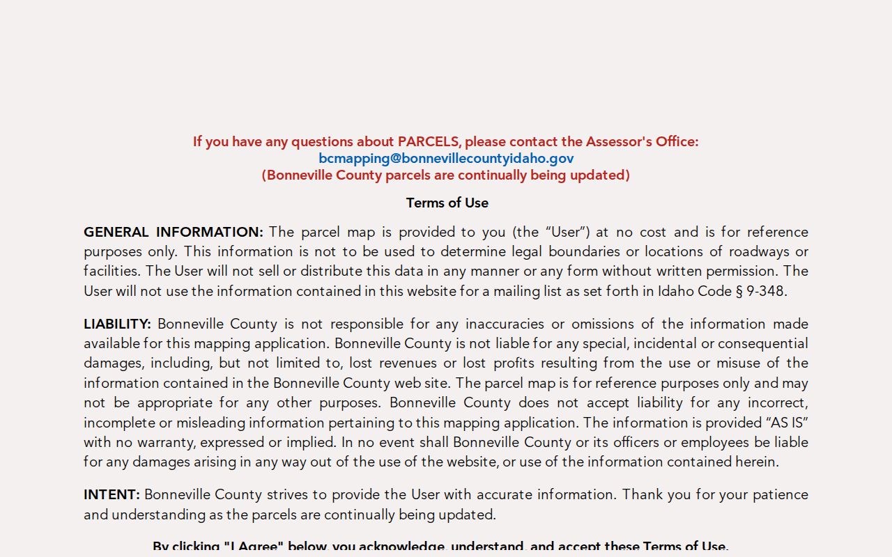
The screen supplies parcel context for the next Recorder search, not a current resident list.
Idaho Falls Street Map Layers
The City Maps collection complements the county viewer. Street Mapping shows streets, parcel boundaries, addresses, facilities, subdivisions, and quarter sections. Zoning and development maps add city limits, land use, overlays, and projects. Historic aerials reach 1954, though the city cautions that imagery before 2000 is less accurate.
Use both map stacks because an Idaho Falls postal address may sit outside the incorporated city. The county Cadastre service adds city-limit, township, section, subdivision, parcel, and public-land layers. A city layer may also have a different update date from the county parcel layer. Save both dates and avoid merging shapes as if they came from one survey.
Review the live Idaho Falls map links before viewing the captured launch page.
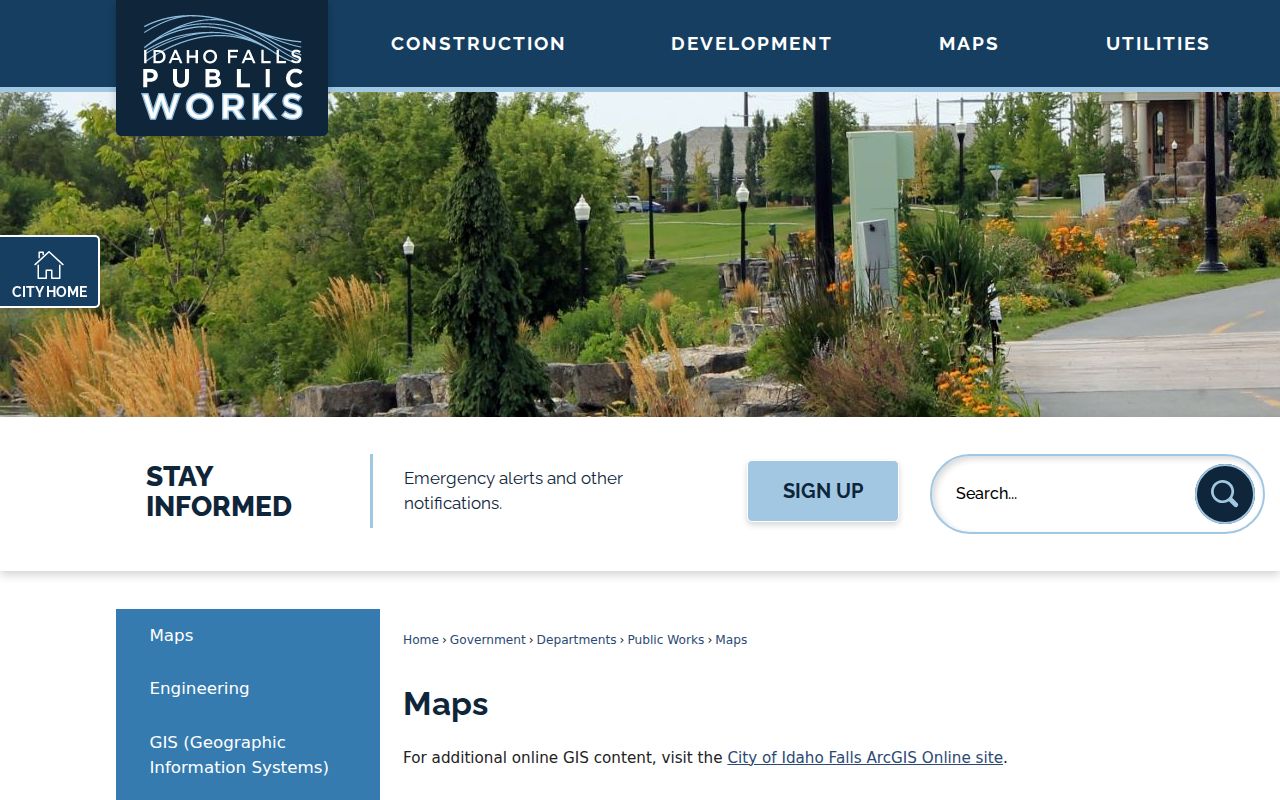
The municipal maps add road, subdivision, and boundary context to the county parcel record.
Idaho Falls Records by Street
The same address can lead to several records, but each answers a different question. The street directory chain is strongest when the parcel ID links map and deed evidence, while a dated directory or voter record separately supports occupancy. City permits and code files describe work or enforcement at an address, not who lived there.
| Address-keyed source | Official keeper | Street evidence | Access route |
|---|---|---|---|
| Parcel and assessment | County Assessor / Mapping | Situs, parcel, tax owner context | Viewer, counter, phone, JustFOIA |
| City and county GIS | GIS / Community Development | Street, parcel, city limit, zoning | Web maps, REST, static PDFs |
| Deeds, liens, plats | County Recorder | Parties, legal description, dates | Index, counter, mail copy |
| Voter registration | County Elections / SOS | Limited public voter fields | Vote Idaho and office |
| Permits and code files | Idaho Falls departments | Project address and named roles | Cityworks or records request |
| Printed directories | ISHS, IFPL, BYU-Idaho | Dated address or street entry | Reel, shelf, catalog, staff |
A mailing address, physical address, and legal description can differ. Copy each exactly. The full legal description belongs in a recorded deed or plat, not an assessment notice.
Bonneville Deeds Along a Street
The Bonneville Official Records Search displayed indexing from January 1, 1911 through the inspection date. Search fields include Both Names, recording start and end dates, instrument number, book, page, grantor, grantee, parcel ID, situs, subdivision, lot, block, tract, unit, section, township, range, document type, and advanced name searching.
Use parcel and situs first, then search each grantor and grantee. A grantor gives an interest; a grantee receives one. Mortgages, releases, liens, plats, and surveys are not all ownership transfers. For documents before 1995, the portal warns against relying on recording dates. Use the name, instrument, or book and page.
Accept the current Recorder disclaimer and inspect the search before using its captured interface.
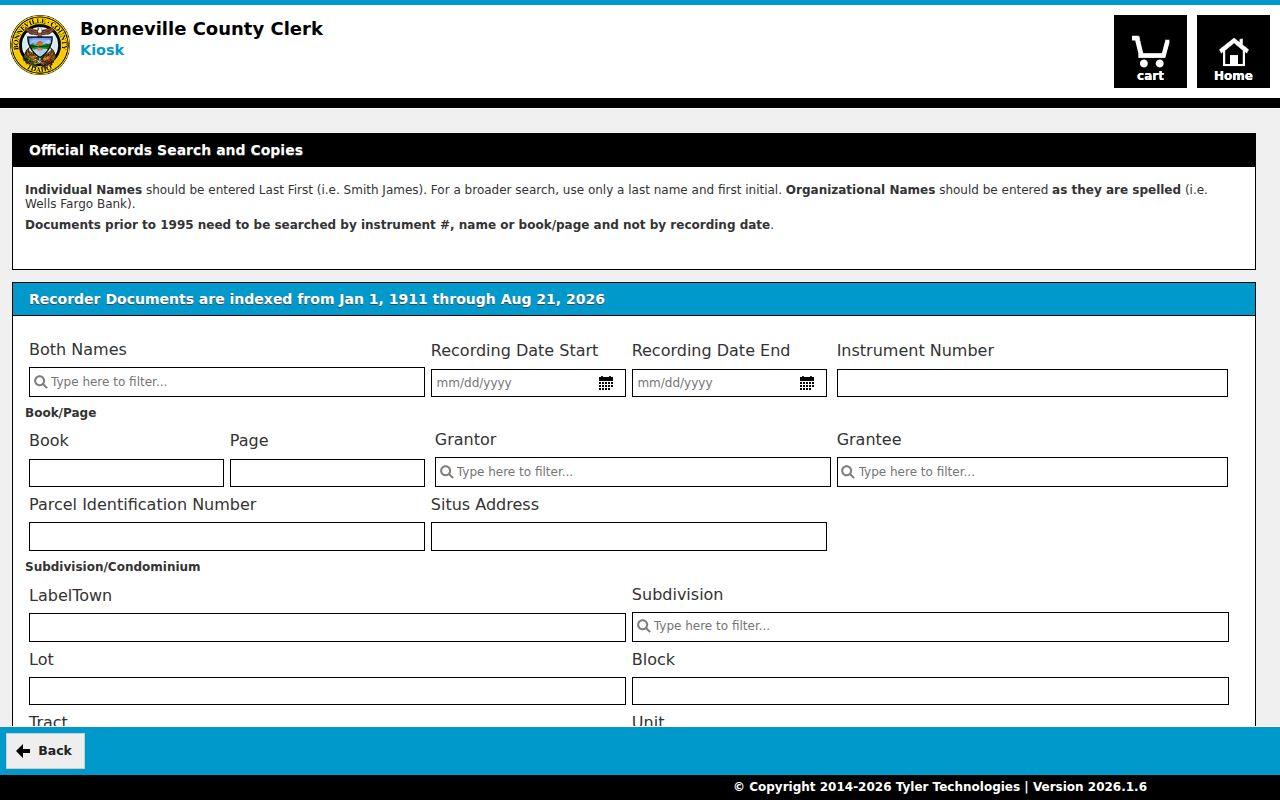
The field-rich form supports a reproducible parcel-to-instrument trail when names or dates alone fail.
Images can be unavailable. The Recorder counter at 605 N Capital Avenue provides in-person copies, and mail requests can include a self-addressed stamped envelope. Record the instrument number before leaving the portal.
Plats Clarify Idaho Falls Addresses
A plat is a recorded map dividing land into lots, blocks, streets, and other tracts. It can bridge a modern address to the subdivision wording in a deed. The Bonneville Platting & Mapping office explains parcel-viewer use, ownership corrections, deed processing, and its limits.
If the street search produces several similar numbers, preserve subdivision, lot, block, tract, unit, section, township, and range. Those fields can locate an instrument even when a road was renamed or renumbered. The separate CP&F index helps with corner-perpetuation and survey material, but it is not a title index.
Read the county mapping cautions before examining the successful capture.
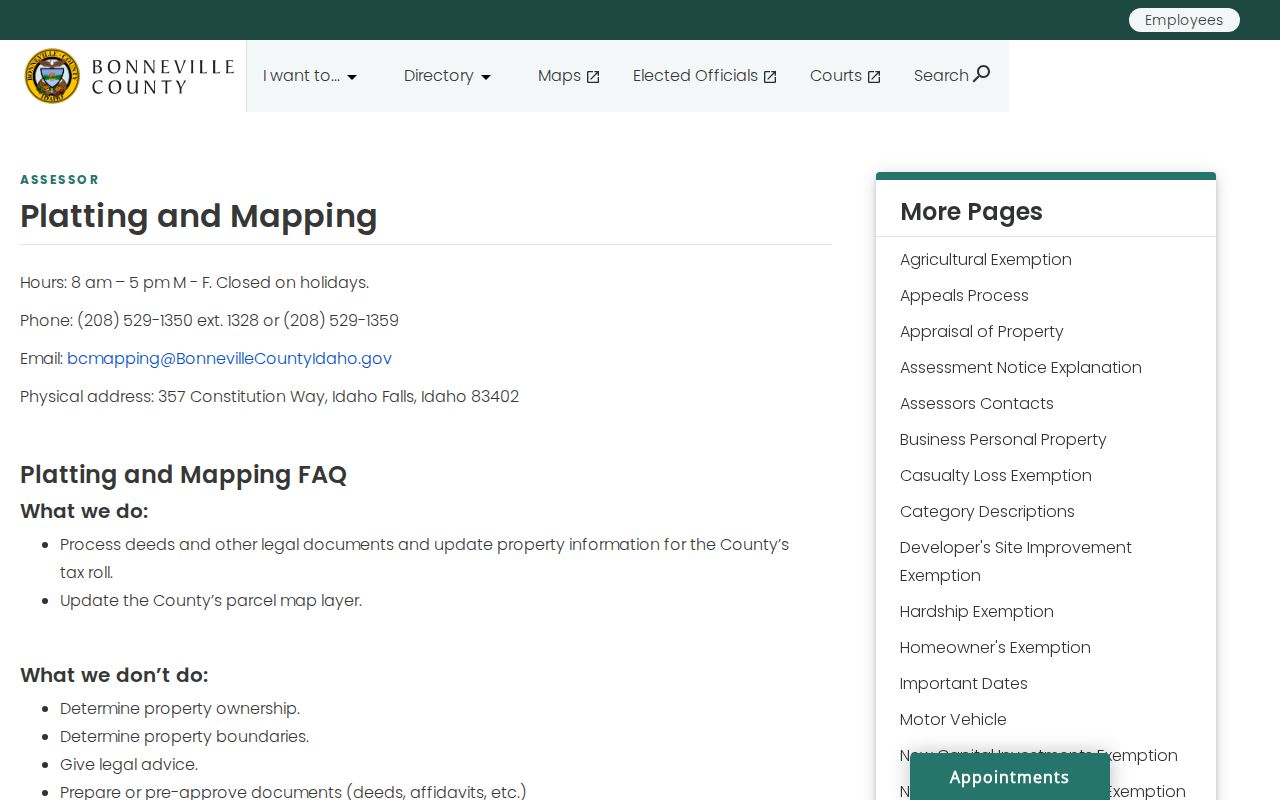
The office guidance shows when to move from a street label to a parcel and legal-description search.
Historic Idaho Falls Street Snapshots
Library of Congress Sanborn maps were located for Idaho Falls in 1900, 1911, and 1921. They show building footprints, street names, construction context, and use at the map date. A missing building may fall outside the located sheet or may not be represented, so absence is not proof that the structure did not exist.
Pair each map with nearby directory years and the recorded plat or deed. The Idaho State Historical Society holds Idaho Falls directory reels from 1907 through 1971 and later shelf leads. Idaho Falls Public Library offers Digital Sanborn through its digital library and can help with catalog sources. BYU-Idaho archives holds local microfilm.
A criss-cross directory is arranged by street or phone rather than only by surname. Ask the library or archive whether a specific volume has a street section. For the collections themselves, use the Idaho Falls city directory material instead of treating a historical volume as a modern street roll.
ZIP Labels on Idaho Falls Streets
ZIP is delivery geography, not a municipal boundary. USPS is authoritative for one deliverable address. Census ZIP Code Tabulation Areas are statistical approximations. The county Recorder has a situs field but no stable ZIP filter, and the parcel viewer guidance lists parcel, name, and situs rather than ZIP.
The working Idaho Falls postal set includes 83401, 83402, 83403, 83404, 83405, 83406, and 83415, but classifications differ. A 2025 USPS container-label change routed 83406 labeling to 83401. That was a logistics change, not a change to city limits. Validate one address in USPS ZIP Code Lookup, then check city and county GIS.
Pre-1960 deeds and directories will not carry a modern ZIP. Add the ZIP only as a present-day crosswalk and label it that way.
Idaho Falls Street Fallbacks
Online access is only one channel. If the Parcel Viewer fails, contact Platting & Mapping at 357 Constitution Way, 208-529-1359, or BCMapping@BonnevilleCountyIdaho.gov. If a deed image is missing, use the Recorder counter or mail. Broader county map requests go through county JustFOIA. City map and permit gaps can go to Community Development Services or the City Clerk's JustFOIA portal.
Historic gaps lead to Idaho Falls Public Library, the Idaho State Historical Society Research Center, FamilySearch, BYU-Idaho archives, and Library of Congress maps. A library computer may reach subscription material unavailable from home. Save every attempted source and date, including a screen that did not render.
- Parcel
- A mapped unit of land with a county identifier.
- Situs address
- The physical parcel location, distinct from mailing address.
- Plat
- A recorded map of lots, blocks, streets, or subdivisions.
- Criss-cross directory
- A directory organized by street or phone number.
Limits of Idaho Falls Street Directory
An Idaho Falls street directory cannot name every occupant. Property records center on title and assessment roles. Voter information covers only registered voters and excludes protected fields. Permits identify project roles, while directories show a dated publication snapshot. Utility customer and motor-vehicle address data are not public resident lists.
Countywide records are not city-only. Bonneville County includes other towns and rural land, and an Idaho Falls postal city line may describe a parcel outside the incorporated city. Trusts, estates, and organizations can also appear as owners. Check the parcel geometry, instrument, date, and role before stating who is linked to an address.
Lawful use. Use Idaho Falls address records only for lawful personal research, and never to stalk, harass, intimidate, or expose protected people.
When a record is sealed, confidential, outside coverage, restricted to an archive login, or absent from an index, label that boundary. “Not located” is more accurate than claiming no record exists.